YOLO: A FUSION APPROACH TO GEOLOCATING NATURAL RESOURCES
Advancing near real-time AI and drone technology to improve wildlife monitoring and conservation in hard-to-reach landscapes.
Management of protected species, and biodiversity in general, requires reliable survey methods for counting and locating wildlife to detect spatiotemporal trends in population sizes. Survey data are an important part of risk assessment and management decisions. Unfortunately, traditional wildlife monitoring methods can costly in terms of time, labor, and resources.
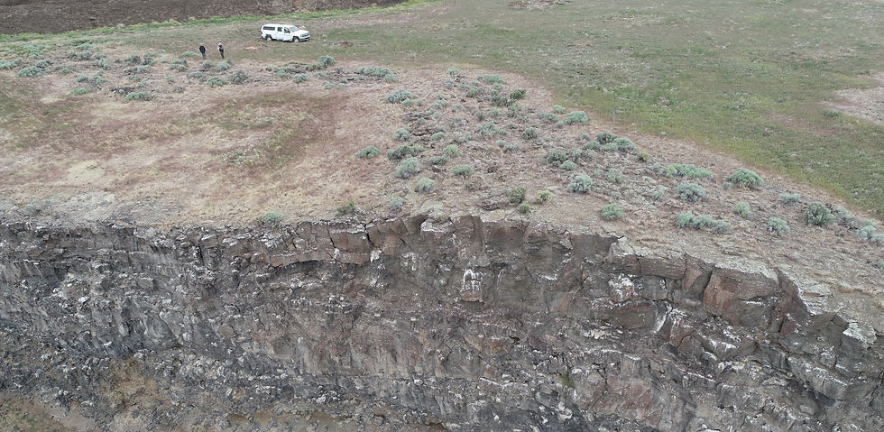
We aim to create a reliable and cost-effective method to monitor wildlife, especially in difficult-to-reach terrains such as vertical cliffs. Uncrewed Aerial Systems (UASs), commonly referred to as drones, have emerged as a potential means of efficiently and accurately collecting data on and monitoring wildlife species. UASs can cover large areas regardless of terrain, can reduce time and labor costs, and minimize researcher disturbance. However, post-flight image download, review, and storage can be time-consuming and expensive. Further, there is a delay between survey time and data acquisition, which can present a challenge for immediate decision-making.
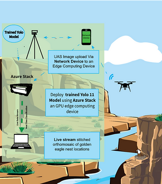
Design and layout of technology and methodology components of study.
Our project aims to develop a time- and cost-effective approach for wildlife monitoring by incorporating near real-time artificial intelligence (AI) detection of wildlife, specifically cliff-nesting Golden Eagles (Aquila chrysaetos), during UAS flights using “you only look once” (YOLO) computer vision model. This approach will combine the benefits of UAS-based surveys (range, efficiency, accessibility) and ground-based surveys (real-time information on wildlife) into one survey method.
We are validating our technology and protocols by surveying in previously unsampled areas and comparing the accuracy, precision, and efficiency of these new methods compared to traditional surveys. This will help to ensure that technology and protocols developed in this project will be transferable across different ecosystems and can be generalized to other taxa.
Ultimately, the goal of this project is to improve the effectiveness and efficiency of DoD natural resource monitoring and assessment. This will be achieved through the development of a novel, state-of-the-art model to identify bird nests in real-time from UAS sensors. Peer-reviewed publications, technical reports, conference presentations, and workshops on the use of YOLO for natural resource monitoring will facilitate results dissemination and technology transfer.